Medieval and Manuscripts
Ely, Cambridgeshire
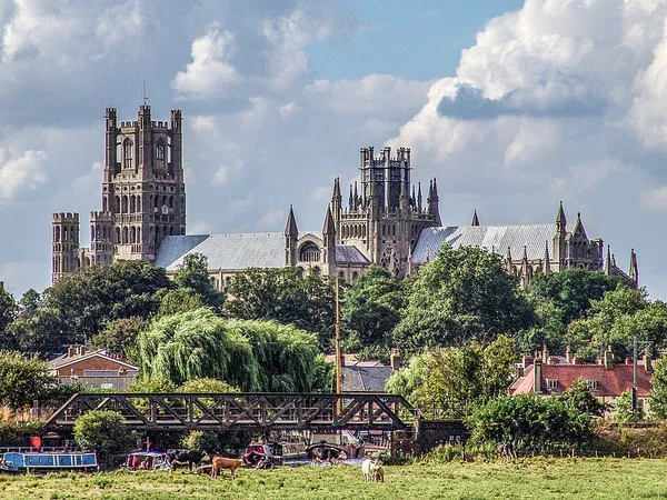
Ely ( EE-lee) is a cathedral city and civil parish in the district of East Cambridgeshire in Cambridgeshire, England. It lies 14 miles (23 km) north-east of Cambridge, 24 miles (39 km) south-east of Peterborough, and 80 miles (130 km) from London. As well as the built up area itself, the parish also covers surrounding rural areas including the settlements of Chettisham, Prickwillow, Mile End, Queen Adelaide, and Stuntney. At the 2021 census the built up area had a population of 19,185 and the parish had a population of 20,574. Ely is built on a 23-square-mile (60 km2) Kimmeridge Clay island which, at 85 feet (26 m), is the highest land in the Fens. It was due to this topography that Ely was not waterlogged like the surrounding Fenland, and an island separated from the mainland. Major rivers including the Witham, Welland, Nene and Great Ouse feed into the Fens and, until draining commenced in the eighteenth century, formed freshwater marshes and meres within which peat was laid down. Once the Fens were drained, this peat created a rich and fertile soil ideal for farming. The River Great Ouse was a significant means of transport until the Fens were drained and Ely ceased to be an island in the seventeenth century. The river is now a popular boating spot and has a large marina. Although now surrounded by land, the city is still known as the Isle of Ely. There are two Sites of Special Scientific Interest in the city: a former Kimmeridge Clay quarry, and one of the United Kingdom's best remaining examples of medieval ridge and furrow agriculture. The economy of the region is mainly agricultural. Before the Fens were drained, eel fishing was an important activity, from which the settlement's name may have been derived. Other important activities included wildfowling, peat extraction, and the harvesting of osier (willow) and sedge (rush). The city had been the centre of local pottery production for more than 700 years, including pottery known as Babylon ware. A Roman road, Akeman Street, passes through the city; the southern end is at Ermine Street near Wimpole and its northern end is at Brancaster. Little direct evidence of Roman occupation in Ely exists, although there are nearby Roman settlements such as those at Little Thetford and Stretham. A coach route, known to have existed in 1753 between Ely and Cambridge, was improved in 1769 as a turnpike (toll road).
Also on this shelf
Interlace (art).
Maybrook Mansion.
See also
Uncatalogued shelfText from Wikipedia; plate via Wikimedia Commons. Text CC BY-SA 4.0; plate freely licensed (see Commons). Source record. Images and catalogue data are reproduced from open-access collections.