Maritime History
Caribou Island Lighthouse
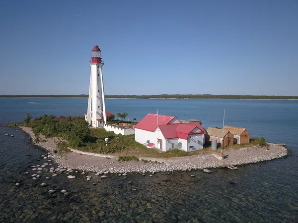
Caribou Island Lighthouse sits on the uninhabited Caribou Island in the eastern end of Lake Superior, 22 miles (35 km) south of Michipicoten Island. It lies entirely within the territorial waters of Canada although only about three miles from the international border between Canada and the United States. It is approximately 3 miles (4.8 km) long and approximately 1 mile (1.6 km) wide. A dangerous reef stretches 1 mile (1.6 km) along the north and west shores of Caribou Island, and a shallow reef 2.5 miles (4.0 km) stretches beyond to the southwest to Caribou Island, lying only 11 feet (3.4 m) below the lake's surface. The unmanned lighthouse, which is owned by the Canadian Coast Guard, is located on a tiny adjacent island called Lighthouse Island a few hundred feet across and positioned 1 mile (1.6 km) west of the southern tip of the main island. When originally built, it was visible for 16 miles (26 km) and operated on a 30-second revolving cycle. Caribou Island is about 55 km (34 mi) off Agawa Bay on the east shore of the lake.
Also on this shelf
HMS Seal (N37).
Dún Laoghaire Harbour.
See also
Uncatalogued shelfText from Wikipedia; plate via Wikimedia Commons. Text CC BY-SA 4.0; plate freely licensed (see Commons). Source record. Images and catalogue data are reproduced from open-access collections.