Maritime History
Boulder Bank
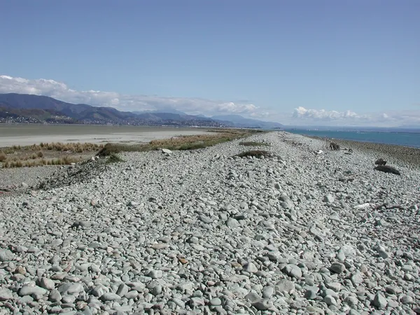
The Boulder Bank (Māori: Te Taero a Keropa or Te Tāhuna o Tama-i-ea) is a very unusual naturally formed landform in Nelson, New Zealand. It is a 13 km (8.1 mi) long stretch of rocky substrate which begins at the Mackay Bluff and ends at the Cut of the Nelson Harbour. Haulashore Island was once a part of the Boulder Bank, but the Cut made it an island, and it is no longer connected to the Boulder Bank. The Boulder Bank separates Tasman Bay and the Nelson Haven and is managed as a scenic reserve by the Department of Conservation. Land access is gained along Boulder Bank Drive, signposted at the northern end of Nelson Haven on State Highway 6.
Also on this shelf
Douglas Harbour.
Aberdeen Harbour.
See also
Uncatalogued shelfText from Wikipedia; plate via Wikimedia Commons. Text CC BY-SA 4.0; plate freely licensed (see Commons). Source record. Images and catalogue data are reproduced from open-access collections.