Maritime History
Inner Ring Road, Chennai
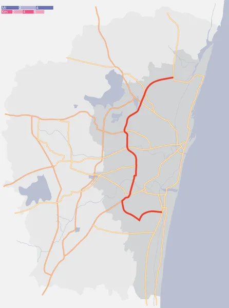
The Inner Ring Road (IRR), also known as Jawaharlal Nehru Salai or 100-Feet road or State Highway 2, is a major transportation corridor encircling the city of Chennai. It was developed by the Chennai Metropolitan Development Authority (CMDA). It is 25.2 km long with three distinct arms viz., Northern arm, Central arm and Southern arm, connecting SH 49A (Rajiv Gandhi Salai) in Tiruvanmiyur, Velachery main road at Vijayanagar, NH 32 (GST road) at Kathipara, NH 4 at Koyambedu, NH 205 at Padi, NH 5 at Madhavaram and joining SH 104 (TPP Road) at Manali.
Also on this shelf
Chennai Metropolitan Development Authority.
HDMS Bellona (1830).
See also
Uncatalogued shelfText from Wikipedia; plate via Wikimedia Commons. Text CC BY-SA 4.0; plate freely licensed (see Commons). Source record. Images and catalogue data are reproduced from open-access collections.