Maritime History
Kaipara Harbour
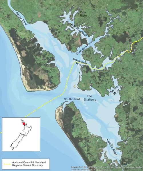
Kaipara Harbour is a large enclosed harbour estuary complex on the north-western side of the North Island of New Zealand. The northern part of the harbour is administered by Kaipara District Council and the southern part by Auckland Council. The local Māori iwi is Ngāti Whātua. By area, the Kaipara Harbour is one of the largest harbours in the world. It covers 947 square kilometres (366 sq mi) at high tide, with 409 square kilometres (158 sq mi) exposed as mudflats and sandflats at low tide. According to Māori tradition, the name Kaipara had its origins in the 15th century when the Arawa chief Kahumatamomoe travelled to the Kaipara to visit his nephew at Pouto. At a feast, he was so impressed with the cooked root of the para fern, that he gave the name Kai-para to the district. Kaipara comes from the Māori kai meaning "food", and para meaning "king fern".
Also on this shelf
HMS Anson (1781).
Kalidasa Kalakendram.
See also
Uncatalogued shelfText from Wikipedia; plate via Wikimedia Commons. Text CC BY-SA 4.0; plate freely licensed (see Commons). Source record. Images and catalogue data are reproduced from open-access collections.