Maritime History
Anholt (island)
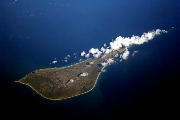
Anholt (Danish pronunciation: [ˈænˌhʌlˀt]) is a Danish island in the Kattegat, midway between Jutland and Sweden at the entrance to the North Sea in Northern Europe. There were 150 permanent residents as of 1 January 2022. Anholt is eleven km (6.8 mi) long and about six km (3.7 mi) wide at its widest, and covers an area of 21.75 km2 (5,370 acres). Anholt is part of Norddjurs Municipality in Region Midtjylland. Before the 2007 municipal reform, it was in Grenå Municipality. The western fifth of Anholt consists of hilly moraine country, while the eastern four-fifths of the island consist of mostly flat raised seabed with some low hills, former wind-blown sand dunes. Only the western moraine hills are inhabited. The eastern part, called "Ørkenen" (The Desert) is treeless; the government has protected the area and permits no building there. The desert has never been ploughed. For this reason the original Stone Age topography from when the glaciation ceased, at the end of the last ice age 10,000 years ago, is still visible in many places. This includes former shorelines inland, consequences of different sea levels over time. The unploughed features of The Desert are unique for Denmark, as well as for this part of Europe. The inhabited part of Anholt has two villages, The Harbour and Anholt Town, inland. There are also 300 to 400 summer houses, some of them rentals.
Also on this shelf
HMS Fury (H76).
German submarine U-3503.
See also
Uncatalogued shelfText from Wikipedia; plate via Wikimedia Commons. Text CC BY-SA 4.0; plate freely licensed (see Commons). Source record. Images and catalogue data are reproduced from open-access collections.