Maritime History
Bay of Bengal
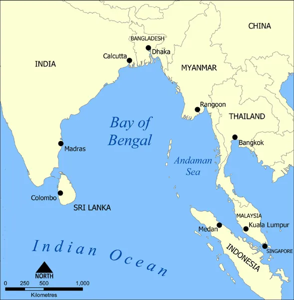
The Bay of Bengal forms the northeastern part of the Indian Ocean, located between the Indian subcontinent and the Indochinese peninsula, south of the Bengal region. Spread across an area of 2,600,000 km2 (1,000,000 sq mi), it is bordered by many of the countries in South Asia and Southeast Asia. Geopolitically, the bay is bound by mainland India on the west and northwest, Bangladesh in the north, Myanmar in the northeast and the Andaman and Nicobar Islands of India in the east. Its southern limit is a line between Sangaman Kanda in Sri Lanka, and the northwesternmost point of Sumatra in Indonesia. Major river systems of the Indian subcontinent such as the Ganges, Brahmaputra, Irrawaddy, Godavari, Krishna, Brahmani, Baitarani, Rushikulya, Mahanadi, and Kaveri flow into the Bay of Bengal. The coast consist of many beaches including some of the world's longest natural beaches, such as Cox's Bazar and Marina, and varied ecosytems such as the Sundarbans, the largest mangrove forest in the world.
Also on this shelf
HMS Confiance (1814).
HMCS Weyburn.
See also
Uncatalogued shelfText from Wikipedia; plate via Wikimedia Commons. Text CC BY-SA 4.0; plate freely licensed (see Commons). Source record. Images and catalogue data are reproduced from open-access collections.