Maritime History
Ardglass
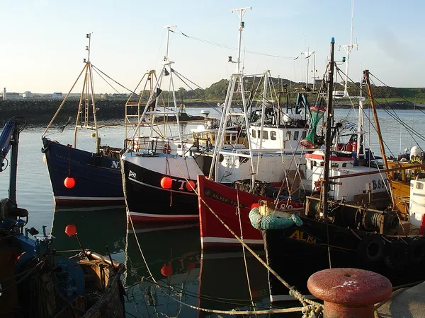
Ardglass (from Irish Ard Ghlais 'green height') is a coastal fishing village, townland (of 321 acres) and civil parish in County Down, Northern Ireland, in the historic barony of Lecale Lower. It is still a relatively important fishing harbour. It is situated on the B1 Ardglass to Downpatrick road, about 6 miles (9.7 kilometres) to the south east of Downpatrick, in the Lecale peninsula on the Irish Sea. It had a population of 1,761 in the 2021 census, and is located within the Newry, Mourne and Down area. The village is a commuter centre for workers in Downpatrick and Belfast, a seaside resort and a local service centre providing housing and a variety of shops and services largely concentrated in Castle Place, Quay Street, Kildare Street and Bath Street. A Conservation area was designated in Ardglass in 1996, focused on its early 19th century street pattern. The village has eight archaeological sites within the area and another two nearby. There are a number of listed properties located on Castle Place, Kildare Street and The Crescent. St Nicholas's Church, King's Castle, Ardglass Castle, Isabella Tower, the disused railway station, the North Pier and the inner Dock are also listed.
Also on this shelf
HMCS Baddeck (K147).
Fort Denison.
See also
Uncatalogued shelfText from Wikipedia; plate via Wikimedia Commons. Text CC BY-SA 4.0; plate freely licensed (see Commons). Source record. Images and catalogue data are reproduced from open-access collections.