Maps and Exploration
Copper Inuit
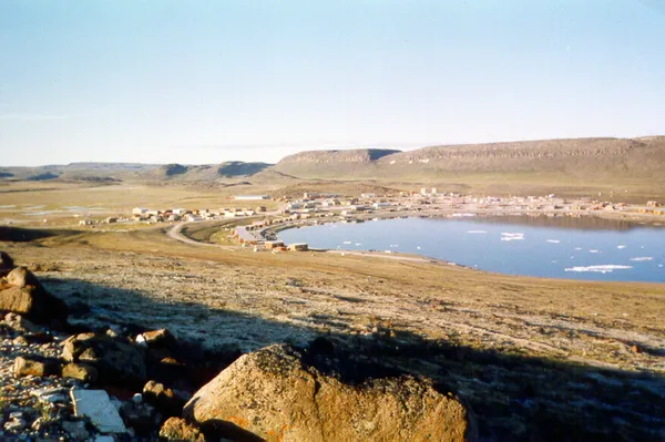
Copper Inuit, also known as Inuinnait and Kitlinermiut, are a Canadian Inuit group who live north of the tree line, in what is now the Kitikmeot Region of Nunavut and in the Inuvialuit Settlement Region in the Inuvik Region of the Northwest Territories. Most of them historically lived in the area around Coronation Gulf, on Victoria Island, and southern Banks Island. Their western boundary was Wise Point, near Dolphin and Union Strait. Their northwest territory was the southeast coast of Banks Island. Their southern boundary was the eastern shore of Great Bear Lake, Contwoyto Lake and Lake Beechey on the Back River. To the east, the Copper Inuit and the Netsilingmiut were separated by Perry River in Queen Maud Gulf. While Copper Inuit travelled throughout Victoria Island, to the west, they concentrated south of Walker Bay, while to the east, they were concentrated south of Denmark Bay. As the people have no collective name for themselves, they have adopted the English term "Copper Inuit". It represents those westernmost Central Inuit who used and relied on native copper gathered along the lower Coppermine River and the Coronation Gulf. According to Knud Rasmussen (1932), other Inuit referred to Copper Inuit as Kitlinermiut, as Kitlineq was an Inuit language name for Victoria Island.
Also on this shelf
Charles Anderson Memorial Bridge.
Burnie Theatre.
See also
Uncatalogued shelfText from Wikipedia; plate via Wikimedia Commons. Text CC BY-SA 4.0; plate freely licensed (see Commons). Source record. Images and catalogue data are reproduced from open-access collections.