Maps and Exploration
Edington, Wiltshire
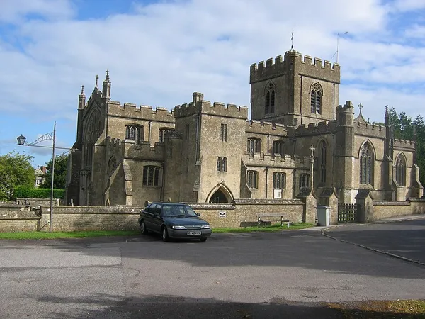
Edington is a village and civil parish in Wiltshire, England, about 4 miles (6 km) east-northeast of Westbury. The village lies under the north slope of Salisbury Plain and the parish extends south onto the Plain. Its Grade I listed parish church was built for Edington Priory in the 14th century. Tinhead is the former name of the eastern half of present-day Edington, towards Coulston along the B3098 Westbury to Market Lavington road. Tinhead is labelled on the Ordnance Survey map of 1945 but not on the 1958 map. Today the combined settlement is Edington and the name survives only in Tinhead Hill and Tinhead Lane.
Also on this shelf
Haymarket railway station.
Bruininks Hall.
See also
Uncatalogued shelfText from Wikipedia; plate via Wikimedia Commons. Text CC BY-SA 4.0; plate freely licensed (see Commons). Source record. Images and catalogue data are reproduced from open-access collections.