Maps and Exploration
Congo Basin
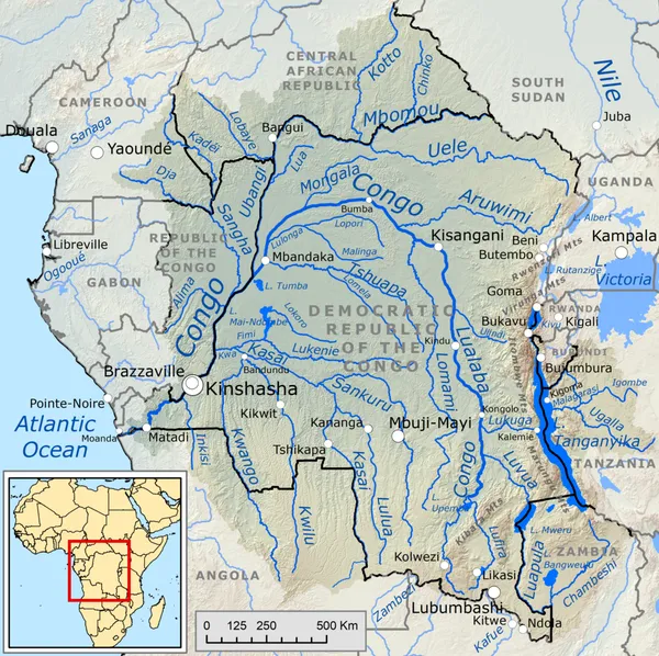
The Congo Basin is the sedimentary basin of the Congo River. The Congo Basin is located in Central Africa, in a region known as west equatorial Africa. The region is sometimes known simply as the Congo. It contains some of the largest tropical rainforests in the world and is an important source of water used in agriculture and energy generation. The rainforest in the Congo Basin is the largest rainforest in Africa and second only to the Amazon rainforest in size, with 300 million hectares compared to the 800 million hectares in the Amazon. Because of its size and diversity the basin's forest is important for mitigating climate change in its role as a carbon sink. However, deforestation and degradation of the ecology by the impacts of climate change may increase stress on the forest ecosystem, in turn making the hydrology of the basin more variable. A 2012 study finds that the variability in precipitation caused by climate change will negatively affect economic activity in the basin. Eight sites of the Congo Basin are inscribed on the World Heritage List, five being also on the list of World Heritage in Danger (all five located in Democratic Republic of the Congo). Fourteen percent of the humid forest is designated as protected.
Also on this shelf
James Cook Collection: Australian Museum.
Demographics of Armenia.
See also
Uncatalogued shelfText from Wikipedia; plate via Wikimedia Commons. Text CC BY-SA 4.0; plate freely licensed (see Commons). Source record. Images and catalogue data are reproduced from open-access collections.