Maps and Exploration
Afar Region
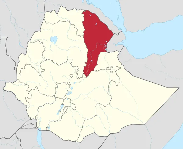
The Afar Region (; Afar: Qafar Rakaakayak; Amharic: ዓፋር ክልል), formerly known as Region 2, is a regional state in northeastern Ethiopia and the homeland of the Afar people. Its capital is the planned city of Semera, which lies on the paved Awash–Assab highway. It is bordered by Eritrea to the north and Djibouti to the northeast; it also shares regional borders with the Tigray, Amhara, Oromo and Somali regions. The Afar Triangle, the northern part of which is the Danakil Depression, is part of the Great Rift Valley of Ethiopia, and is located in the north of the region. It has the lowest point in Ethiopia and one of the lowest in Africa. The southern part of the region consists of the valley of the Awash River, which empties into a string of lakes along the Djibouti–Ethiopia border. Other notable landmarks include the Awash National Park. Afar Region is a developing region of Ethiopia with a high rate of fertility.
Also on this shelf
Bertie County, North Carolina.
History of Canada.
See also
Uncatalogued shelfText from Wikipedia; plate via Wikimedia Commons. Text CC BY-SA 4.0; plate freely licensed (see Commons). Source record. Images and catalogue data are reproduced from open-access collections.