Maps and Exploration
2014 Iquique earthquake
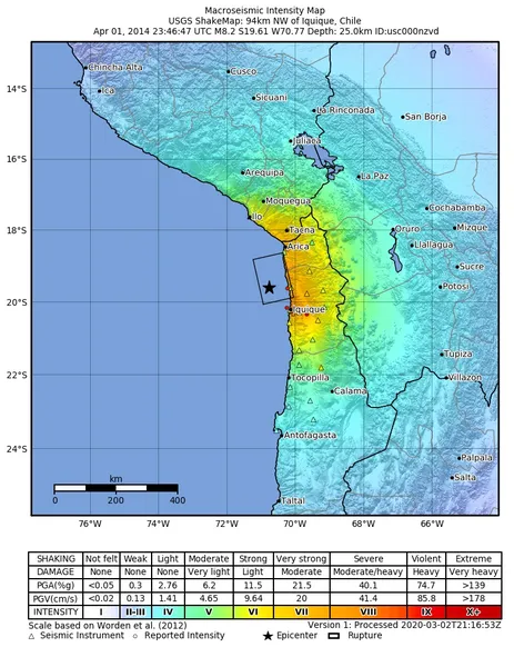
The 2014 Iquique earthquake struck off the coast of Chile on 1 April, with a moment magnitude of 8.1–8.2, at 20:46 local time (23:46 UTC). The epicenter of the earthquake was approximately 95 kilometres (59 mi) northwest of Iquique. The mainshock was preceded by a number of moderate to large shocks and was followed by a large number of moderate to very large aftershocks, including a M7.7 event on 3 April. The megathrust earthquake triggered a tsunami of up to 2.11 metres (6.9 ft) that hit Iquique at 21:05 local time (00:05 UTC, 2 April). Similar-sized tsunamis were also reported to have hit the coasts of Pisagua and Arica.
Also on this shelf
Fyodor Matisen.
Cartography of the United States.
See also
Uncatalogued shelfText from Wikipedia; plate via Wikimedia Commons. Text CC BY-SA 4.0; plate freely licensed (see Commons). Source record. Images and catalogue data are reproduced from open-access collections.