Maps and Exploration
Bas-Saint-Laurent
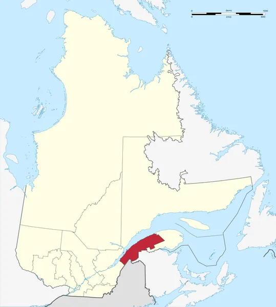
The Bas-Saint-Laurent (French pronunciation: [ba sɛ̃ lɔʁɑ̃], 'Lower Saint-Lawrence) is an administrative region of Quebec located along the south shore of the lower Saint Lawrence River in Quebec. The river widens at this place, later becoming a bay that discharges into the Atlantic Ocean and is often nicknamed "Bas-du-Fleuve" (Lower-River). The region is formed by eight regional county municipalities and 114 municipalities. In the south, it borders the US state of Maine, the Canadian province of New Brunswick and the Quebec administrative regions of Chaudière-Appalaches and Gaspésie–Îles-de-la-Madeleine. It had a population of 199,039 and a land area of 22,188.19 km2 (8,566.91 sq mi) as of the 2021 census. The territory has evidence of human occupation since the Pleistocene by successive indigenous peoples. The historic First Nations occupied it all until European colonisation started in the late 17th century; France made land concessions to settlers under the Seigneurial system of New France to encourage colonization. However, development of this region was slow until it started to exploit its mixed forests. Settlement gradually developed further inland, on the littoral, and since the late 20th century a leisure and recreation industry has developed. Its geography is marked by the Saint Lawrence River to the northwest, the Notre Dame Mountains section of the Appalachians, as well as the Matapédia and Témiscouata valleys, which forms the natural communication corridors with the Gaspé Peninsula, the state of Maine in the United States, and the Maritimes.
Also on this shelf
Farthest North.
History of Antarctica.
See also
Uncatalogued shelfText from Wikipedia; plate via Wikimedia Commons. Text CC BY-SA 4.0; plate freely licensed (see Commons). Source record. Images and catalogue data are reproduced from open-access collections.