Maps and Exploration
Albers projection
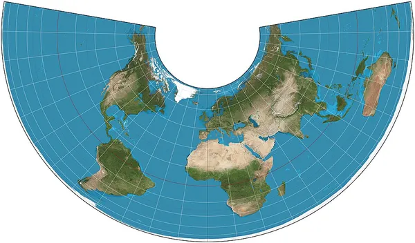
Albers projection
The Albers equal-area conic projection, or Albers projection, is a conic, equal area map projection that uses two standard parallels. Although scale and shape are not preserved, distortion is minimal between the standard parallels. It was first described by Heinrich Christian Albers (1773-1833) in a German geography and astronomy periodical in 1805.
Also on this shelf
Discovery Hut.
Cacho Island.
See also
Uncatalogued shelfText from Wikipedia; plate via Wikimedia Commons. Text CC BY-SA 4.0; plate freely licensed (see Commons). Source record. Images and catalogue data are reproduced from open-access collections.
Depth 5
Shelf 804d6696877b2c
25,934 catalogued holdings
3 ways on