Maps and Exploration
Bass Strait
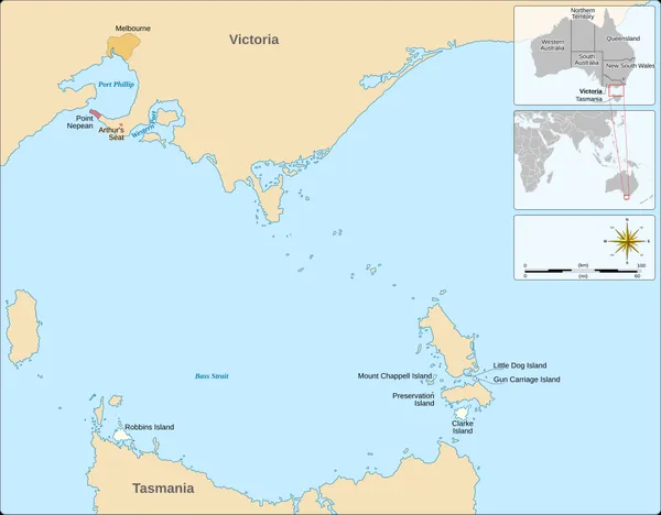
Bass Strait is a strait separating the island state of Tasmania from the Australian mainland (more specifically the coast of Victoria, with the exception of the land border across Boundary Islet). The strait provides the most direct waterway between the Great Australian Bight and the Tasman Sea, and is also the only maritime route into the economically prominent Port Phillip Bay. Formed 8,000 years ago by rising sea levels at the end of the last glacial period, the strait was named after English explorer and physician George Bass (1771–1803) by European colonists.
Also on this shelf
Brightline.
Fort Lee, New Jersey.
See also
Uncatalogued shelfText from Wikipedia; plate via Wikimedia Commons. Text CC BY-SA 4.0; plate freely licensed (see Commons). Source record. Images and catalogue data are reproduced from open-access collections.