Maps and Exploration
2010 Sahel famine
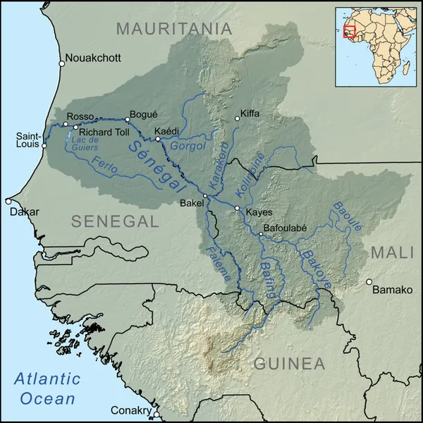
A large-scale, drought-induced famine occurred in Africa's Sahel region and many parts of the neighbouring Sénégal River Area from February to August 2010. It is one of many famines to have hit the region in recent times. The Sahel is the ecoclimatic and biogeographic zone of transition between the Sahara desert in the north of Africa and the Sudanian savannas in the south, covering an area of 3,053,200 square kilometres. It is a transitional ecoregion of semi-arid grasslands, savannas, steppes, and thorn shrublands. The neighbouring Sénégal River Area contains various vegetation types and covers parts or all of Mauritania, Mali, Senegal and Guinea. It has also had very low rainfall over the last year according to the UN, NGOs and the Senegal River Basin Development Authority. Sudan set a new temperature record of 49.7 °C (121.3 °F) on 22 June, in the town of Dongola.
Also on this shelf
Garudimimus.
Area codes 602, 480, and 623.
See also
- ▸2016 United States presidential election
- ▸Cathedral of the Annunciation, Moscow
- ▸Croydon Police Station
Text from Wikipedia; plate via Wikimedia Commons. Text CC BY-SA 4.0; plate freely licensed (see Commons). Source record. Images and catalogue data are reproduced from open-access collections.