Maps and Exploration
Arctic Archipelago
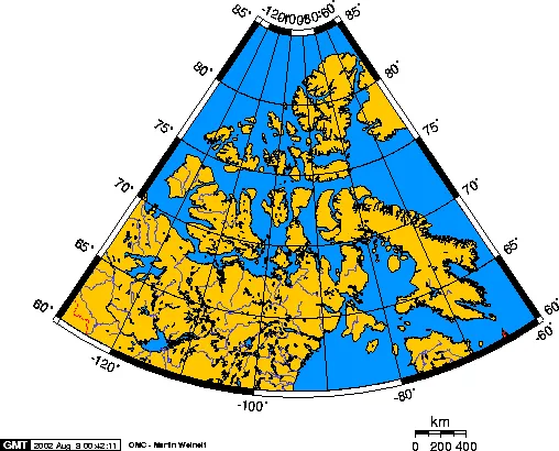
The Arctic Archipelago, also known as the Canadian Arctic Archipelago, is an archipelago lying to the north of the Canadian continental mainland, excluding Greenland (an autonomous territory of the Danish Realm, which is, by itself, much larger than the combined area of the archipelago), and Iceland (an independent country). Situated in the northern extremity of North America and covering about 1,424,500 km2 (550,000 sq mi), this group of 36,563 islands, surrounded by the Arctic Ocean, comprises much of Northern Canada, predominantly Nunavut and the Northwest Territories. The archipelago is showing some effects of climate change, with some computer estimates determining that melting there will contribute 3.5 cm (1.4 in) to the rise in sea levels by 2100.
Also on this shelf
Bratvaag Expedition.
Bad Saarow.
See also
Uncatalogued shelfText from Wikipedia; plate via Wikimedia Commons. Text CC BY-SA 4.0; plate freely licensed (see Commons). Source record. Images and catalogue data are reproduced from open-access collections.