Maps and Exploration
Columbia River Crossing
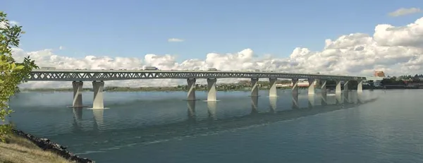
The Columbia River Crossing (CRC) was a proposed joint freeway megaproject from 2005 to 2013 between Oregon and Washington, which proposed to widen and modernize Interstate 5 where it crossed the Columbia River. Central to this was the replacement of the Interstate Bridge, a pair of through-truss bridges. The northbound bridge dates to 1917, and its nearly identical companion was opened in 1958 to carry southbound traffic. The bridges, the earlier of which pre-dates the U.S. Highway System by nine years, served as the crossing for U.S. Route 99 before the establishment of the Interstate Highway System and Interstate 5 as the new route number. Each of the current bridges currently has three traffic lanes and no emergency lanes. Each bridge also has a vertical-lift draw bridge span on the Washington State side of the river to allow shipping traffic access upriver. The CRC was intended to be a safer, more modern bridge, with greater capacity, including light rail to directly connect with the regional MAX system. It would also have replaced or modified seven freeway interchanges south of SR-500. "Project partners" included the Federal Highway Administration and the Federal Transit Administration, cities of Vancouver and Portland, the Southwest Washington Regional Transportation Council, Metro, and transit agencies C-Tran and TriMet. Other agencies were involved as part of "task forces," but the project was blocked July 2013 by Republican opposition within the Washington State Senate.
Also on this shelf
Flat Earth.
Gnomonic projection.
See also
Uncatalogued shelfText from Wikipedia; plate via Wikimedia Commons. Text CC BY-SA 4.0; plate freely licensed (see Commons). Source record. Images and catalogue data are reproduced from open-access collections.