Maps and Exploration
Fort Conger
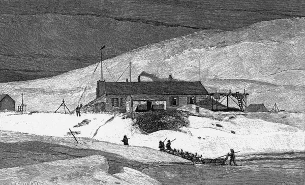
Fort Conger is a former settlement, military fortification, and scientific research post in the Qikiqtaaluk Region, Nunavut, Canada. It was established in 1881 as an Arctic exploration camp, notable as the site of the first major northern polar region scientific expedition, the Lady Franklin Bay Expedition, led by Adolphus Greely as part of the United States government's contribution to the First International Polar Year. It was later occupied by Robert Peary during some of his Arctic expeditions. Fort Conger is located on the northern shore of Lady Franklin Bay in Grinnell Land, northeastern Ellesmere Island within Quttinirpaaq National Park. Bellot Island lies across from Fort Conger within Discovery Harbour. Though lacking in timber, the area is characterized by grasses and sedges. The surroundings are rugged and boast high cliffs around the harbour. Now uninhabited, it is one of only a handful of previously staffed stations in the Queen Elizabeth Islands. In 1991, some of the structures at Fort Conger were designated as Classified Federal Heritage Buildings.
Also on this shelf
Brahmaputra River.
Economy of Canada.
See also
Uncatalogued shelfText from Wikipedia; plate via Wikimedia Commons. Text CC BY-SA 4.0; plate freely licensed (see Commons). Source record. Images and catalogue data are reproduced from open-access collections.