Maps and Exploration
Cocos Island
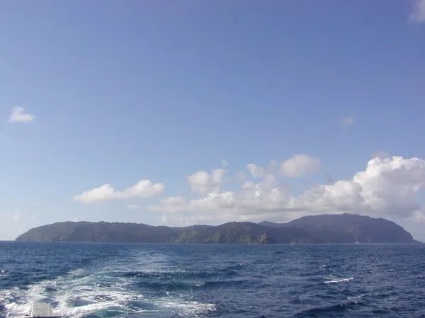
Cocos Island (Spanish: Isla del Coco) is a volcanic island in the Pacific Ocean administered by Costa Rica, approximately 550 km (342 mi; 297 nmi) southwest of the Costa Rican mainland. It constitutes the 11th of the 15 districts of Puntarenas Canton of the Province of Puntarenas. With an area of approximately 23.85 km2 (9.21 sq mi), the island is roughly rectangular in shape. It is the southernmost point of geopolitical North America if non-continental islands are included, and the only landmass above water on the Cocos tectonic plate. The island has been designated a Costa Rican National Park since 1978 and has no inhabitants other than park rangers. Surrounded by deep waters with counter-currents, Cocos Island is admired by scuba divers for its populations of hammerhead sharks, rays, dolphins and other large marine species. The wet climate and oceanic qualities give Cocos an ecological character that is not shared with either the Galápagos Archipelago or other islands in the eastern Pacific, such as Malpelo, Gorgona or Coiba. Because of the unique ecology of the island and its surrounding waters, Cocos Island National Park became a UNESCO World Heritage Site in 1997. It can only be reached by sea, which usually takes 36 to 48 hours.
Also on this shelf
Alexander Macklin.
Baltimore.
See also
Uncatalogued shelfText from Wikipedia; plate via Wikimedia Commons. Text CC BY-SA 4.0; plate freely licensed (see Commons). Source record. Images and catalogue data are reproduced from open-access collections.