Maps and Exploration
Hampton Roads
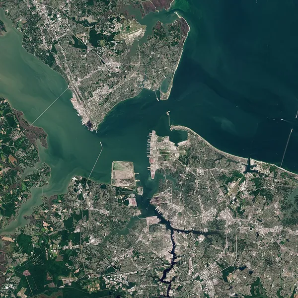
Hampton Roads is a body of water in the United States that serves as a wide channel for the James, Nansemond, and Elizabeth rivers between Old Point Comfort and Sewell's Point near the point at which the Chesapeake Bay flows into the Atlantic Ocean. It also gave its name to the surrounding metropolitan region located in the southeastern Virginia and northeastern North Carolina portions of the Tidewater Region. Comprising the Virginia Beach-Chesapeake-Norfolk, VA-NC Metropolitan Statistical Area and an extended combined statistical area that includes the Elizabeth City, North Carolina, micropolitan statistical area and Kill Devil Hills, North Carolina, micropolitan statistical area, Hampton Roads is known for its large military presence, ice-free harbor, shipyards, coal piers, and miles of waterfront property and beaches. The body of water known as Hampton Roads is one of the world's largest natural harbors (more accurately a roadstead or "roads"). It incorporates the mouths of the Elizabeth, Nansemond, and James rivers, together with several smaller rivers, and empties into the Chesapeake Bay near its mouth leading to the Atlantic Ocean. The land area includes a collection of cities, counties, and towns on the Virginia Peninsula and in South Hampton Roads. Some of the outlying areas further from the harbor may or may not be included as part of "Hampton Roads", depending upon the organization or usage. For example, as defined for federal economic purposes, the Hampton Roads metropolitan statistical area (MSA) includes three counties in northeastern North Carolina and two counties in Virginia's Middle Peninsula. The Virginia Beach-Chesapeake-Norfolk, VA-NC MSA has an estimated 2025 population of 1,797,213, making it the 37th-largest metropolitan area in the United States. The combined statistical area (CSA) includes two additional counties in North Carolina, pushing the regional population to 1,877,659 residents, the 36th-largest CSA in the country. The area is home to hundreds of historical sites and attractions. The harbor was the key to Hampton Roads' growth, both on land and in water-related activities and events.
Also on this shelf
Bathymetric chart.
Caspian Sea.
See also
Uncatalogued shelfText from Wikipedia; plate via Wikimedia Commons. Text CC BY-SA 4.0; plate freely licensed (see Commons). Source record. Images and catalogue data are reproduced from open-access collections.