Maps and Exploration
Adirondack Park
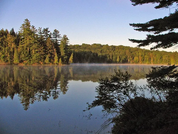
The Adirondack Park is the designation for a large area of northeastern New York centered on the Adirondack Mountains. Like Catskill Park to the south, the area is unusual in the United States because, while the entire area is considered "parkland", about 52 percent of the land within the boundary consists of privately owned inholdings. The remaining 48 percent is publicly owned by the state as part of the Forest Preserve. Use of public and private lands in the park is regulated by the Adirondack Park Agency. The park was established in 1892 for "the free use of all the people for their health and pleasure", and for watershed protection. At 6.1 million acres (25,000 km2), it is the largest park in the contiguous United States. The Adirondack Park contains the 46 High Peaks, 2,800 lakes and ponds, 30,000 miles (48,000 km) of rivers and streams, and an estimated 200,000 acres (81,000 ha) of old-growth forests. It is home to 105 towns and villages, as well as numerous farms, businesses, and a timber-harvesting industry. The park has a population of 130,000 permanent and 200,000 seasonal residents, and sees over 12.4 million annual visitors. The inclusion of human communities has been described as one of the most successful experiments in conserving previously developed lands in the industrialized world. The Adirondack Forest Preserve was designated a National Historic Landmark in 1963.
Also on this shelf
Liberty Science Center.
Cordillera Administrative Region.
See also
Uncatalogued shelfText from Wikipedia; plate via Wikimedia Commons. Text CC BY-SA 4.0; plate freely licensed (see Commons). Source record. Images and catalogue data are reproduced from open-access collections.