Maps and Exploration
Bjørnøya
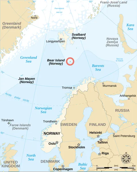
Bear Island (Norwegian: Bjørnøya, pronounced [ˈbjø̀ːɳœʏɑ]) is the southernmost island of the Norwegian Svalbard archipelago. The island is located at the limits of the Norwegian and Barents seas, approximately halfway between Spitsbergen and the North Cape. Bear Island was discovered by Dutch explorers Willem Barentsz and Jacob van Heemskerck on 10 June 1596. It was named after a polar bear that was seen swimming nearby. The island was considered terra nullius until the Spitsbergen Treaty of 1920 placed it under Norwegian sovereignty. Despite its remote location and barren nature, the island has seen commercial activities in past centuries, such as coal mining, fishing and whaling. However, no settlements have lasted more than a few years, and Bear Island is now uninhabited except for personnel working at the island's meteorological station Bjørnøya radio. Along with the adjacent waters, it was declared a nature reserve in 2002.
Also on this shelf
Cajamarca.
Australasian Antarctic Expedition.
See also
Uncatalogued shelfText from Wikipedia; plate via Wikimedia Commons. Text CC BY-SA 4.0; plate freely licensed (see Commons). Source record. Images and catalogue data are reproduced from open-access collections.