Maps and Exploration
Boggs eumorphic projection
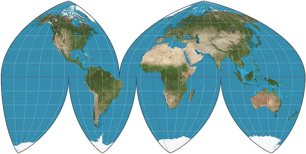
The Boggs eumorphic projection is a pseudocylindrical, equal-area map projection used for world maps. Normally it is presented with multiple interruptions. Its equal-area property makes it useful for presenting spatial distribution of phenomena. The projection was developed in 1929 by Samuel Whittemore Boggs (1889–1954) to provide an alternative to the Mercator projection for portraying global areal relationships. Boggs was geographer for the United States Department of State from 1924 until his death. The Boggs eumorphic projection has been used occasionally in textbooks and atlases. Boggs generally repeated regions in two different lobes of the interrupted map in order to show Greenland or eastern Russia undivided. He preferred his interrupted version, and named it "eumorphic", meaning "goodly shaped" (in Boggs's own words). The projection's mathematical development was completed by Oscar S. Adams of the United States Coast and Geodetic Survey.
Also on this shelf
Island of California.
First Parish Church Site-Dover Point.
See also
Uncatalogued shelfText from Wikipedia; plate via Wikimedia Commons. Text CC BY-SA 4.0; plate freely licensed (see Commons). Source record. Images and catalogue data are reproduced from open-access collections.