Maps and Exploration
Cartography of Asia
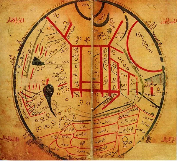
The cartography of Asia can refer to the representation of Asia on a map, or to depictions of the world by cartographers from Asia. Depictions of portions of Asia have existed on maps as early as the 6th century BCE, with maps being drafted to depict the Babylonian, Hellenistic Greek, and Han dynasty empires. During the Middle Ages, Muslim geographers drew maps with more accurate depictions of Southern, Western, and Central Asia, and European maps began to more frequently represent Asia's landmass. Chinese geography from this period includes more detailed portrayals of the Indian Ocean, Arabian Peninsula, and East Africa. European maps of Asia would become much more accurate during the European Age of Discovery, starting in the 15th century. Modern maps of Asia make use of digitization, photographic surveys, and satellite imagery.
Also on this shelf
Cèllere Codex.
Briesen (Mark).
See also
Uncatalogued shelfText from Wikipedia; plate via Wikimedia Commons. Text CC BY-SA 4.0; plate freely licensed (see Commons). Source record. Images and catalogue data are reproduced from open-access collections.