Maps and Exploration
Cumberland Narrows
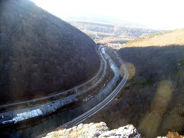
The Cumberland Narrows (or simply The Narrows) is a water gap in western Maryland in the United States, just west of Cumberland. Wills Creek cuts through the central ridge of the Wills Mountain Anticline at a low elevation here between Wills Mountain to the north and Haystack Mountain to the south. Cliffs and talus of the two mountains' Tuscarora quartzite caprock are prominent within the Narrows. A prominent rocky outcropping at the south end of Wills Mountain in the Cumberland Narrows is known as Lover's Leap. The geological features of the Narrows provide Cumberland a western backdrop of the two mountains with a narrow gap between them.
Also on this shelf
2018 Sulawesi earthquake and tsunami.
Castle Bravo.
See also
Uncatalogued shelfText from Wikipedia; plate via Wikimedia Commons. Text CC BY-SA 4.0; plate freely licensed (see Commons). Source record. Images and catalogue data are reproduced from open-access collections.