Maps and Exploration
Christmas Island
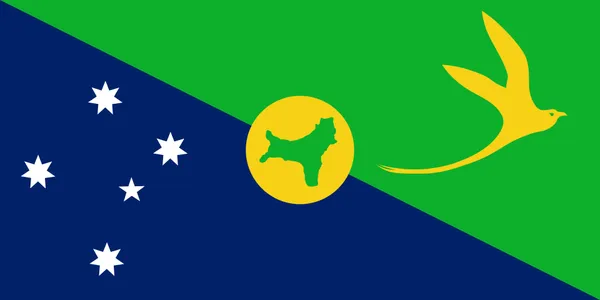
Christmas Island, officially the Territory of Christmas Island, is an Australian external territory in the Indian Ocean comprising the island of the same name. It is about 350 kilometres (190 nautical miles; 220 miles) south of Java and Sumatra and about 1,550 km (840 nmi; 960 mi) north-west of the closest point on the Australian mainland. It has an area of 135 square kilometres (52 sq mi). Christmas Island's geographic isolation and history of minimal human disturbance has led to a high level of endemism among its flora and fauna, which is of interest to scientists and naturalists. The territory derives its name from its discovery on Christmas Day 1643 by Captain William Mynors. The first European to sight Christmas Island was Richard Rowe of the Thomas in 1615. Mynors gave it its name. It was first settled in the late 19th century, after abundant phosphate deposits were found (originally deposited as guano) which led Britain to annex the island in 1888 and begin commercial mining in 1899. The Japanese invaded the island in 1942 to secure its phosphate deposits. After the end of Japanese occupation, the island's administration was restored to Singapore, but it was transferred to Australia in 1958, where it has remained since. Christmas Island had a population of 1,692 as of 2021, with most living in settlements on its northern edge. The main settlement is Flying Fish Cove, known simply as The Settlement. Other settlements include Poon Saan, Drumsite, and Silver City. Historically, Asian Australians of Chinese, Malay, and Indian descent were the majority of the population. Today, around two-thirds of the island's population is estimated to have Straits Chinese origin (though just 22.2% of the population declared Chinese ancestry in 2021), with significant numbers of Malays and European Australians and smaller numbers of Straits Indians and Eurasians. Several languages are in use, including English, Malay, and various Chinese dialects. Religious beliefs vary geographically. The Anglo-Celtic influence in the capital is closely tied to Catholicism, whereas Buddhism is common in Poon Saan, and Sunni Islam is generally observed in the shoreline water village where the Malays live. The majority (63%) of the island is made up of Christmas Island National Park, which features several areas of primary monsoonal forest.
Also on this shelf
British Australian and New Zealand Antarctic Research Expedition.
CityLynx Gold Line.
See also
Uncatalogued shelfText from Wikipedia; plate via Wikimedia Commons. Text CC BY-SA 4.0; plate freely licensed (see Commons). Source record. Images and catalogue data are reproduced from open-access collections.