Maps and Exploration
Columbia River
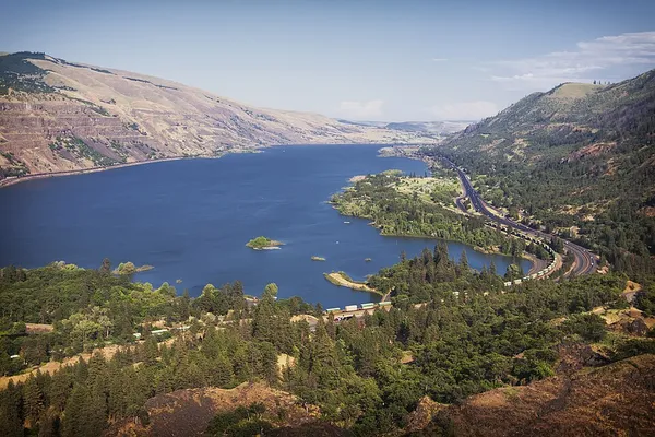
The Columbia River (Upper Chinook: Wimahl or Wimal; Sahaptin: Nch’i-Wàna or Nchi wana; Sinixt dialect swah'netk'qhu) is the largest river in the Pacific Northwest region of North America. The river forms in the Rocky Mountains of British Columbia, Canada. It flows northwest and then south into the U.S. state of Washington, then turns west to form most of the border between Washington and the state of Oregon before emptying into the Pacific Ocean. The river is 1,243 miles (2,000 kilometers) long, and its largest tributary is the Snake River. Its drainage basin is roughly the size of France and extends into seven states of the United States and one Canadian province. The fourth-largest river in the United States by flow, the Columbia has the greatest flow of any river into the eastern Pacific. The Columbia and its tributaries have been central to the region's culture and economy for thousands of years. They have been used for transportation since ancient times, linking the region's many cultural groups. The river system hosts many species of anadromous fish, which migrate between freshwater habitats and the saline waters of the Pacific Ocean. These fish—especially the salmon species—provided the core subsistence for native peoples. The first documented European discovery of the Columbia River occurred when Spanish explorer Bruno de Heceta sighted the river's mouth in 1775. On May 11, 1792, a private American ship, Columbia Rediviva, under Captain Robert Gray from Boston became the first non-indigenous vessel to enter the river. Later that same year William Robert Broughton of the British Royal Navy commanding HMS Chatham as part of the Vancouver Expedition, navigated past the Oregon Coast Range and 100 mi (160 km) upriver to what is now Vancouver, Washington. In the following decades, fur-trading companies used the Columbia as a key transportation route. Overland explorers entered the Willamette Valley through the scenic but treacherous Columbia River Gorge, and pioneers began to settle the valley in increasing numbers. Steamships along the river linked communities and facilitated trade; the arrival of railroads in the late 19th century, many running along the river, supplemented these links. Since the late 19th century, public and private sectors have extensively developed the river.
Also on this shelf
2018 Sulawesi earthquake and tsunami.
Cape Jervis (headland).
See also
Uncatalogued shelfText from Wikipedia; plate via Wikimedia Commons. Text CC BY-SA 4.0; plate freely licensed (see Commons). Source record. Images and catalogue data are reproduced from open-access collections.