Maps and Exploration
Hans Island
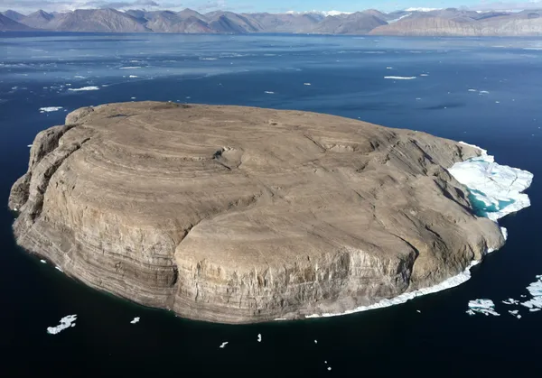
Hans Island (Inuktitut and Greenlandic: Tartupaluk, lit. 'kidney shaped'; Inuktitut syllabics: ᑕᕐᑐᐸᓗᒃ; Danish: Hans Ø, pronounced [hanˀs øˀ]; French: île Hans, pronounced [il ɑ̃(n)s]) is an island in the centre of the Kennedy Channel of the Nares Strait in the high Arctic region, split between the Canadian territory of Nunavut and the Danish rigsdel (autonomous territory) of Greenland. The island itself is barren and uninhabited with an area of 130 ha (320 acres), measuring 1,290 by 1,199 m (4,232 by 3,934 ft), and a maximum elevation of 168.17 m (551.7 ft). Its location in the strait that separates Ellesmere Island of Canada from northern Greenland was for years a border dispute, the so-called Whisky War between the two sovereign states of Canada and the Danish Realm, officially the Kingdom of Denmark. Hans Island is the smallest of three islands in Kennedy Channel off the Washington Land coast; the others are Franklin Island and Crozier Island. The strait at this point is 35 km (22 mi) wide, placing the island within the territorial waters of both Canada and the Danish Realm (Greenland). A 1,280 m (4,200 ft) shared border traverses the island. The island has likely been part of Inuit hunting grounds since the 14th century. It was claimed by both Canada and Denmark until 14 June 2022, when both countries agreed to split the disputed island roughly in half. In accordance with the Greenland home rule treaty, Denmark handles certain foreign affairs, such as border disputes, on behalf of the entire Danish Realm.
Also on this shelf
Economy of India.
Churchill, Manitoba.
See also
Uncatalogued shelfText from Wikipedia; plate via Wikimedia Commons. Text CC BY-SA 4.0; plate freely licensed (see Commons). Source record. Images and catalogue data are reproduced from open-access collections.