Geology and Minerals
Isis Temple
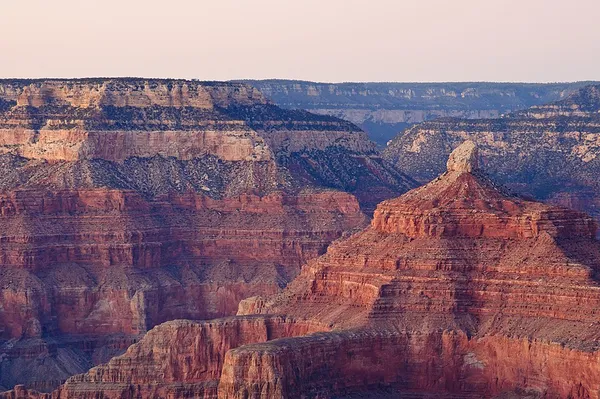
Isis Temple is a prominence in the Grand Canyon, Arizona, Southwestern United States. It is located below the North Rim and adjacent to the Granite Gorge along the Colorado River. The Trinity Creek and canyon flow due south at its west border; its north, and northeast border/flank is formed by Phantom Creek (Phantom Ranch, about 2,460 ft (750 m)) and canyon, a west tributary of Bright Angel Creek; the creeks intersect about 3 mi (4.8 km) southeast, and 1.0 mi (1.6 km) north of Granite Gorge. The Isis Temple prominence (a short remainder caprock of bright-white Coconino Sandstone, on an erosion slope of brownish Hermit Formation), is only about 202 ft (62 m) lower than Grand Canyon Village, the main public center on Grand Canyon’s South Rim. Isis Temple is about 5 mi (8.0 km) directly north of Grand Canyon Village on the South Rim, Grand Canyon; the Village is the west terminus of Arizona Route 64 (East Rim Drive), and north terminus of U.S. 180, from Valle, Arizona, and Williams (about 58 mi (93 km) south). Isis Temple is part of an uplifted, and sub-faulted block (about 3.5 mi (5.6 km) long and 2.0 mi (3.2 km) wide), with a sub-peak landform, Cheops Pyramid 5,392 ft (1,643 m), about 1,600 ft (488 m) lower in elevation, and 1.0 mi (1.6 km) southeast of the Isis Temple prominence. The Isis prominence is composed of erosion resistant cliff-forming Coconino Sandstone.
Also on this shelf
Kone (volcano).
Harmonic tremor.
See also
Uncatalogued shelfText from Wikipedia; plate via Wikimedia Commons. Text CC BY-SA 4.0; plate freely licensed (see Commons). Source record. Images and catalogue data are reproduced from open-access collections.