Geology and Minerals
Clough Head
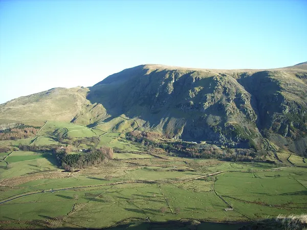
Clough Head ( ) (meaning: hill-top above the ravine) is a fell, or hill, in the English Lake District. It marks the northern end of the main ridge of the Helvellyn range and is often walked as part of the ridge walk. The fell stands south of the village of Threlkeld and the A66 road, and it forms the steep eastern side of the tranquil valley of St John's in the Vale. On its western side the fell displays a dark mass of rocky crags and a deep-set rocky ravine. On the other side it has smooth grassy slopes. Beneath the north face is the steep valley or clough from which Clough Head gets its name. Also beneath the steep northern face lies the lower hill of Threlkeld Knotts, a granite hill which has been much quarried round its margin. A number of different types of rock are found on and around Clough Head, which were formed in very different circumstances. These include deep-sea sedimentation, effusive volcanic lava flows, explosive volcanism, an intrusion of granite, mineralisation and finally glacial sculpting. To understand the geology of Clough Head is to understand much of the geology of the Lake District. An old route known as the Old Coach Road passes beneath Clough Head. Most of the fell is Open Access land, which walkers can enter from either end of the Old Coach Road, or from a lane south of the village of Threlkeld. Four main routes lead to the summit.
Also on this shelf
Cañadón Asfalto Formation.
Abiquiu Formation.
See also
Uncatalogued shelfText from Wikipedia; plate via Wikimedia Commons. Text CC BY-SA 4.0; plate freely licensed (see Commons). Source record. Images and catalogue data are reproduced from open-access collections.