Geology and Minerals
Amazonis quadrangle
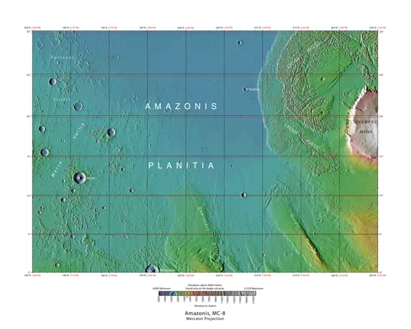
The Amazonis quadrangle is one of a series of 30 quadrangle maps of Mars used by the United States Geological Survey (USGS) Astrogeology Research Program. The Amazonis quadrangle is also referred to as MC-8 (Mars Chart-8). The quadrangle covers the area from 135° to 180° west longitude and 0° to 30° north latitude on Mars. The Amazonis quadrangle contains the region called Amazonis Planitia. This area is thought to be among the youngest parts of Mars because it has a very low density of craters. The Amazonian Epoch is named after this area. This quadrangle contains special, unusual features called the Medusae Fossae Formation and Sulci.
Also on this shelf
Hilina Slump.
1815 eruption of Mount Tambora.
See also
Uncatalogued shelfText from Wikipedia; plate via Wikimedia Commons. Text CC BY-SA 4.0; plate freely licensed (see Commons). Source record. Images and catalogue data are reproduced from open-access collections.