Geology and Minerals
Cinder Cone and the Fantastic Lava Beds
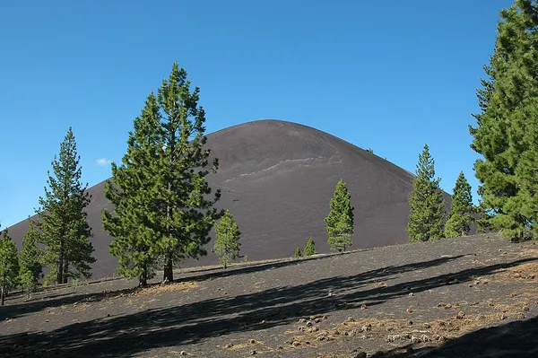
Cinder Cone is a cinder cone volcano in Lassen Volcanic National Park within the United States. It is located about 10 mi (16 km) northeast of Lassen Peak and provides an excellent view of Brokeoff Mountain, Lassen Peak, and Chaos Crags. The cone was built to a height of 750 ft (230 m) above the surrounding area and spread ash over 30 sq mi (78 km2). Then, like many cinder cones, it was snuffed out when several basalt lava flows erupted from its base. These flows, called the Fantastic Lava Beds, spread northeast and southwest, and dammed creeks, first creating Snag Lake on the south and then Butte Lake to the north. Butte Lake is fed by water from Snag Lake seeping through the lava beds. Nobles Emigrant Trail goes around Snag Lake and follows the edge of the lava beds. Its age has been controversial since the 1870s, when many people thought it was only a few decades old. Later, the cone and associated lava flows were thought to have formed about 1700 or during a 300-year- long series of eruptions ending in 1851. Recent studies by U.S. Geological Survey (USGS) scientists, working in cooperation with the National Park Service to better understand volcanic hazards in the Lassen area, have firmly established that Cinder Cone was formed during two eruptions that occurred in the 1650s.
Also on this shelf
Journey to the Centre of the Earth.
Flood basalt.
See also
Uncatalogued shelfText from Wikipedia; plate via Wikimedia Commons. Text CC BY-SA 4.0; plate freely licensed (see Commons). Source record. Images and catalogue data are reproduced from open-access collections.