Geology and Minerals
Geography of Sri Lanka
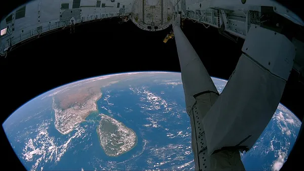
Sri Lanka, formerly called Ceylon, is an island country in the Indian Ocean, southeast of the Indian subcontinent, in a strategic location near major sea lanes. The nation has a total area of 65,610 square kilometres (25,330 sq mi), with 64,630 square kilometres (24,950 sq mi) of land and 980 square kilometres (380 sq mi) of water. Its coastline is 1,340 kilometres (830 mi) long. The main island of Sri Lanka has an area of 64, 058 km2; it is the twenty-fifth largest island in the world by area, similar in size to Tasmania. Dozens of offshore islands account for the remaining 1552 km2 area. The largest offshore island, Jaffna Island is separated by Chundikulam lagoon and Mannar Island, is linked to Adam's Bridge, a land connection to the Indian mainland, which is now mostly submerged with only a chain of limestone shoals remaining above sea level. According to temple records, this natural causeway was formerly whole, but was breached by a violent storm (probably a cyclone) in 1480. The formation is also known as Rama's Bridge, as according to Hindu mythology, it was constructed during the rule of Lord Rama. Sri Lanka's climate includes tropical monsoons; the northeast monsoon (December to March), and the southwest monsoon (June to October). Its terrain is mostly low, flat to rolling plain, with the mountainous upcountry in the south-central interior. The highest point is Pidurutalagala at 2,524 m (8,281 ft). Natural resources include limestone, graphite, mineral sands, gems, phosphates, and clay.
Also on this shelf
Biofuel.
Cathedral Peak Granodiorite.
See also
Uncatalogued shelfText from Wikipedia; plate via Wikimedia Commons. Text CC BY-SA 4.0; plate freely licensed (see Commons). Source record. Images and catalogue data are reproduced from open-access collections.