Geology and Minerals
Geography of Vermont
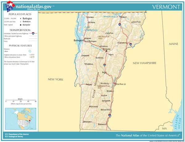
The U.S. state of Vermont is located in the New England region of the northeastern United States and comprises 9,614 square miles (24,900 km2), making it the 45th-largest state. Land comprises 9,250 square miles (24,000 km2) and water comprises 365 square miles (950 km2), making it the 43rd-largest in land area and the 47th in water area. In total area, it is larger than El Salvador and smaller than Haiti. It is the only landlocked state in New England, and it is the easternmost and the smallest in area of all landlocked states. Vermont's overall geography can be best characterized as extremely rugged and densely forested, with outposts of civilization centered around rivers and the (relatively) flat and arable Champlain Valley in the northwest, and ultimately divided by the Green Mountains, which contribute to a rural and very much Appalachian landscape. The average elevation of Vermont is 1000 feet above sea level, and the highest elevation is the summit of Mount Mansfield at 4,395 feet above sea level. The Green Mountains in Vermont form a north–south spine running most of the length of the state, slightly west of its center. In the southwest portion of the state are located the Taconic Mountains. In the northwest, near Lake Champlain, is the fertile Champlain Valley. In the south of the valley is Lake Bomoseen. Many towns and villages in Vermont are separated by (comparatively) lower hills and mountains, connected by rural highways and high passes referred to variously as notches, gaps or gulfs. The endless rugged terrain contributes heavily to Vermont's rural character and acts as a natural barrier to large scale population growth. Indeed, 66% of all mileage of road in Vermont is "paved" with dirt or gravel, and annually results in springtime's mud season, where runoff snowmelt causes dirt backroads to become nearly impassable to motor vehicles, often to the amusement of locals. Vermont's extremely rugged terrain is the almost certain explanation for why the state has remained so sparsely populated; After Maine, Vermont has the lowest population density of any state east of the Mississippi River. Burlington, at only ~45,000 people is the largest city, and is situated in the (relatively) flat and populated Champlain Valley.
Also on this shelf
Manton Valley AVA.
Argyre quadrangle.
See also
Uncatalogued shelfText from Wikipedia; plate via Wikimedia Commons. Text CC BY-SA 4.0; plate freely licensed (see Commons). Source record. Images and catalogue data are reproduced from open-access collections.