Geology and Minerals
Geology of the Canary Islands
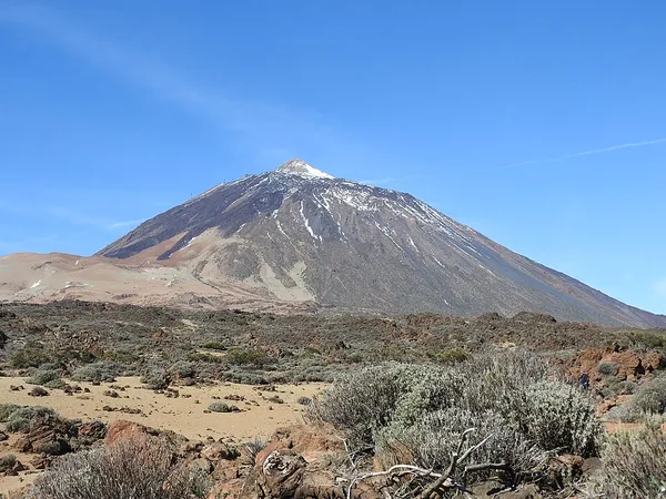
The geology of the Canary Islands is dominated by volcanoes and volcanic rock. The Canary Islands are a group of volcanic islands in the North Atlantic Ocean, near the coast of Northwest Africa. Geologically, the main islands are Lanzarote, Fuerteventura, Gran Canaria, Tenerife, La Gomera, La Palma, and El Hierro. There are also some minor islands and islets. The Canary Islands are on the African tectonic plate but they are far from the plate's edges; the islands are therefore an example of intraplate volcanism. The Canary Islands, and some associated underwater volcanic mountains on the ocean floor, are in the Canary Volcanic Province. The current long period of volcanic activity in this province started about 70 million years ago. For many millions of years, all the volcanic eruptions in the province occurred on the ocean floor. In the last 20.2 million years, enough lava has accumulated at several of the underwater volcanic mountains to build them above sea level, forming the Canary Islands. The eastern islands emerged first, followed by each of the more westerly islands, in turn. Volcanic activity has occurred during the Holocene Epoch (the last 11,700 years) on all of the main islands except La Gomera. The Canary Islands region is still volcanically active. The most recent volcanic eruption on land occurred in 2021 and the most recent underwater eruption was in 2011–2012.
Also on this shelf
Flatiron (geomorphology).
Geology of Italy.
See also
Uncatalogued shelfText from Wikipedia; plate via Wikimedia Commons. Text CC BY-SA 4.0; plate freely licensed (see Commons). Source record. Images and catalogue data are reproduced from open-access collections.