Geology and Minerals
Carrizo Plain
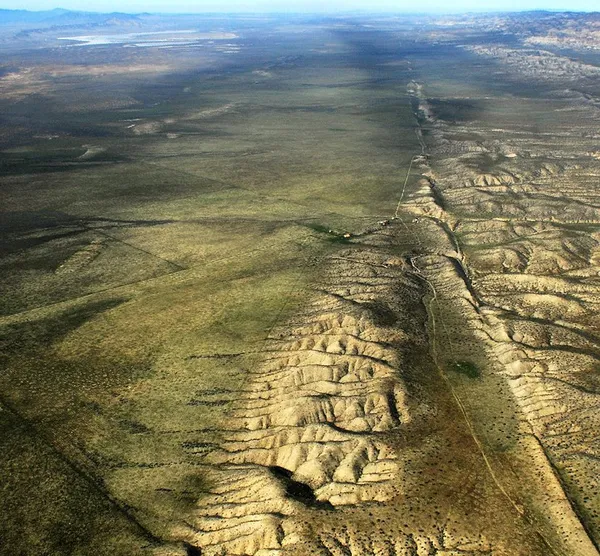
The Carrizo Plain (Obispeño: tšɨłkukunɨtš, "Place of the rabbits") is a large enclosed grassland plain, approximately 50 miles (80 km) long and up to 15 miles (24 km) across, in southeastern San Luis Obispo County, California, United States, about 100 miles (160 km) northwest of Los Angeles. The southern portion of the Carrizo Plain is within the 246,812-acre (99,881 ha) Carrizo Plain National Monument, which also includes most of the Caliente Range. The Carrizo Plain is the largest single native grassland remaining in California. It includes Painted Rock in the Carrizo Plain Rock Art Discontiguous District, which is listed on the National Register of Historic Places. In 2012, it was further designated a National Historic Landmark for its archaeological value. The San Andreas Fault occurs along the eastern edge of the Carrizo Plain at the western base of the Temblor Range. The plain is enclosed between the Temblor Range to the northeast and the Caliente Range to the southwest and drains inward to Soda Lake, a closed alkali basin with no outlet. The climate is semi-arid, with 7 to 10 inches (178 to 254 mm) of rain a year falling mostly between November and April; in wet years the plain produces wildflower displays that draw visitors from across the state. Surveys of the monument have recorded 51 vegetation alliances, most of them shrub-dominated, with juniper and oak woodland on the surrounding slopes. The grassland supports species that have lost most of their range elsewhere in the San Joaquin Valley, among them the giant kangaroo rat, San Joaquin antelope squirrel and pronghorn. The territories of the Chumash, Salinan and Yokuts peoples met on the plain, and the pictographs at Painted Rock, made over a span of some three thousand years, are among the most significant rock art in North America. Europeans settled from the 1860s, running wheat and cattle, but rising costs ended most farming by 1980 and the land passed to the federal government and The Nature Conservancy. President Bill Clinton proclaimed the national monument on January 12, 2001. Oil and gas leasing, solar development and grazing have all been contested on the plain since.
Also on this shelf
Glacier Bay National Park and Preserve.
Deep sea mining.
See also
Uncatalogued shelfText from Wikipedia; plate via Wikimedia Commons. Text CC BY-SA 4.0; plate freely licensed (see Commons). Source record. Images and catalogue data are reproduced from open-access collections.