Geology and Minerals
Geography of Antarctica
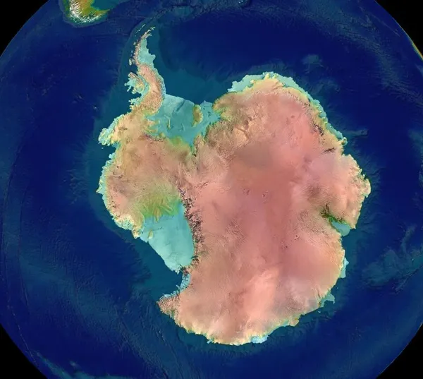
The geography of Antarctica is dominated by its south polar location and, thus, by ice. The Antarctic continent, located in the Earth's Southern Hemisphere, is centered asymmetrically around the South Pole and largely south of the Antarctic Circle. It is washed by the Southern (or Antarctic) Ocean or, depending on definition, the southern Pacific, Atlantic, and Indian Oceans. It has an area of more than 14,200,000 square kilometres or 5,480,000 square miles. Antarctica is the largest ice desert in the world. Some 98% of Antarctica is covered by the Antarctic ice sheet, the world's largest ice sheet and also its largest reservoir of fresh water. Averaging at least 1.6 kilometres or 1 mile thick, the ice is so massive that it has depressed the continental bedrock in some areas more than 2.5 kilometres or 1.6 miles below sea level; subglacial lakes of liquid water also occur (e.g. Lake Vostok). Ice shelves and rises populate the ice sheet on the periphery. The present Antarctic ice sheet accounts for 90 percent of Earth's total ice volume and 70 percent of its fresh water. It houses enough water to raise global sea level by 200 feet or 60 metres. In September 2018, researchers at the National Geospatial-Intelligence Agency released a high resolution terrain map (detail down to the size of a car, and less in some areas) of Antarctica, named the "Reference Elevation Model of Antarctica" (REMA).
Also on this shelf
Gakkel Ridge Caldera.
Boundary Waters Canoe Area Wilderness.
See also
Uncatalogued shelfText from Wikipedia; plate via Wikimedia Commons. Text CC BY-SA 4.0; plate freely licensed (see Commons). Source record. Images and catalogue data are reproduced from open-access collections.