Geology and Minerals
Arkoma Basin
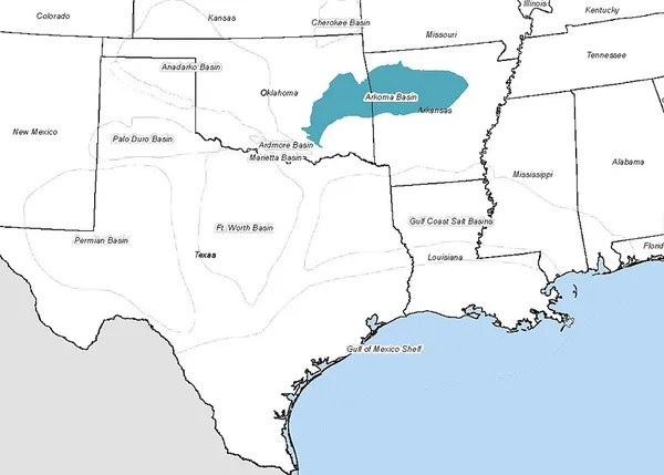
The Arkoma Basin is a peripheral foreland basin that extends from central west Arkansas to south eastern Oklahoma. The basin lies in between the Ozark Uplift and Oklahoma Platform to the north and Ouachita Mountains to the south and with an area of approximately 33,800 mi2. Along the southern edge of the basin, the Choctaw Fault is the boundary that separates the mountains from the basin itself. This basin is one of seven that lie along the front of the Ouachita and Appalachian mountain systems. This basin is Oklahoma's fourth largest in terms of natural gas production. Oil has been extracted locally, but not on a commercial scale. Coal was the first natural resource used commercially within the basin. Surface mapping of coal seams in the early part of the 20th century lead to the discovery of sub-surface features that indicated the presence of natural gas. Mansfield, Arkansas was the site of the first natural gas discovery in 1902.
Also on this shelf
Dinosaur egg.
Copper Basin (Tennessee).
See also
Uncatalogued shelfText from Wikipedia; plate via Wikimedia Commons. Text CC BY-SA 4.0; plate freely licensed (see Commons). Source record. Images and catalogue data are reproduced from open-access collections.