Geology and Minerals
Bogoslof Island
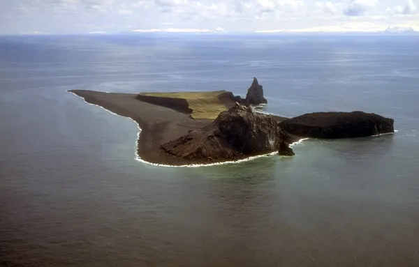
Bogoslof Island or Agasagook Island (Aleut: Aĝasaaĝux̂) is the summit of a submarine stratovolcano at the south edge of the Bering Sea, 35 miles (56 km) northwest of Unalaska Island of the Aleutian Islands chain. It has a land area of 319.3 acres (1.292 km2) and is uninhabited. It is 1,040 meters (3,410 ft) long and 1,512 m (4,961 ft) wide, with a peak elevation of 490 feet (150 m). The stratovolcano rises about 6,000 ft (1,800 m) from the seabed, but the summit is the only part that projects above sea level. The island is believed to be relatively new, with the volcano being entirely below sea level before 1796, and most of the presently 300-acre island being formed by eruptions since 1900.
Also on this shelf
Great Sydney Dyke.
Ephemeral acid saline lake.
See also
Uncatalogued shelfText from Wikipedia; plate via Wikimedia Commons. Text CC BY-SA 4.0; plate freely licensed (see Commons). Source record. Images and catalogue data are reproduced from open-access collections.