Geology and Minerals
Geology of Mayotte
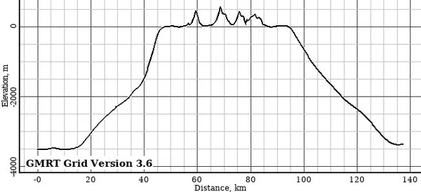
As part of the Comoro Islands chain in the Mozambique Channel, the geology of Mayotte is virtually the same as the geology of the Comoros, the rest of the island chain which is independent of France. The island resulted from the rifting of Madagascar away from Africa as well as "hotspot" mantle plume activity, and is also impacted by seismicity and deformation associated with the East African Rift. However, because Mayotte is a part of France its geology is significantly more researched than that of other islands in the chain. Mayotte is a primarily volcanic island rising steeply from the bed of the ocean to a height of 660 metres (2,170 ft) on Mont Bénara. Two volcanic centres are reported, a southern one (Pic Chongui, 594 metres (1,949 ft), with a breached crater to the NW, and a northern centre (Mont M'Tsapéré, 572 metres (1,877 ft)) with a breached crater to the south-east. Mont Bénara is between these two peaks, approximately at the contact point of the two structures. Volcanic activity started about 7.7 million years ago in the south, ceasing about 2.7 million years ago. In the north, activity started about 4.7 million years ago and lasted until about 1.4 million years ago. Both centres had several phases of activity. Ash bands found in the corals suggest some continuing minor activity. The most recent age reported for an ash band is 7000 year BP.
Also on this shelf
Carbon dioxide in the atmosphere of Earth.
Baculites.
See also
Uncatalogued shelfText from Wikipedia; plate via Wikimedia Commons. Text CC BY-SA 4.0; plate freely licensed (see Commons). Source record. Images and catalogue data are reproduced from open-access collections.