Geology and Minerals
Denison Trough
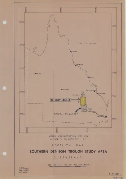
The Denison Trough is a geological feature that has developed into a hydrocarbon province. Located in Central Queensland, it covers much of the western Bowen Basin. Its sediments were laid down during various geologic eras, and at its deepest the trough contains 6.5 kilometres (4.0 mi) of deposits from the Permian and Triassic. The Denison Trough shares some hydrocarbons with other parts of the Bowen Basin, but has become particularly notable for its natural gas reserves, some of which have been commercially extracted. The main part of the Denison Trough formed during the Permian and Early to Mid-Triassic. Geological formations from this period overlie sediment from the Devonian, with little or no Carboniferous material in between. The formations found provide evidence of different environmental periods, as what became the Denison Trough was at various times a riverine, perhaps swampy, environment, and at other times was coastal or part of a shallow sea. The shifting environment is reflected both in the sediment material of different formations, and the fossils found within these sediments. Geologic surveys of the area began in the 1920s, and accelerated in the 1960s after oil was found nearby. Various hydrocarbon pockets were found by different companies in the decades following, a majority of which was found within one formation referred to as the Aldebaran Sandstone. The completion of a gas pipeline to Gladstone in 1990 allowed for gas to be more easily transported and then exported. The natural gas produced in this trough often has high levels of carbon dioxide, although the reasons for this have not been determined.
Also on this shelf
Geology of Mars.
Geography of Sydney.
See also
Uncatalogued shelfText from Wikipedia; plate via Wikimedia Commons. Text CC BY-SA 4.0; plate freely licensed (see Commons). Source record. Images and catalogue data are reproduced from open-access collections.