Geology and Minerals
1960 eruption of Kīlauea
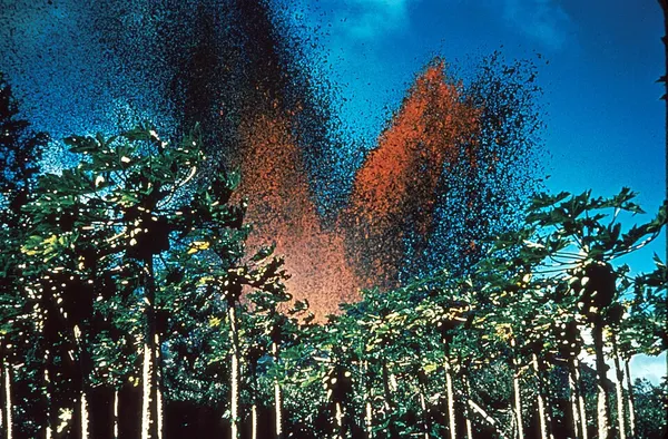
The 1960 eruption of Kīlauea occurred from January 13 to February 19, 1960, on Kīlauea, the most active volcano in Hawaii, US. It followed the eruption of late 1959 in Kīlauea Iki, near the volcano's summit. Fissure vents opened up on the eastern tip of the island of Hawaii, just outside the town of Kapoho. Fountains of lava erupt from these fissures, forming a flow that advances into the Pacific Ocean. As the lava threatened homes, several makeshift dykes were erected in quick succession, but they were soon overtopped and Kapoho was finally destroyed. At the summit of the volcano, earthquakes hit the caldera rim and three collapses affect the floor of the Halemaʻumaʻu crater, with lava appearing as a remnant of a previous eruption. After an eruption lasting just over a month, the third most powerful to hit Kīlauea in the 20th century, the lava covered more than 10 square kilometers of land, including 2 square kilometers of sea, and pushed Cape Kumukahi, the easternmost point of the island of Hawaii, a little further east.
Also on this shelf
Geology of Virginia.
Cherry Springs State Park.
See also
Uncatalogued shelfText from Wikipedia; plate via Wikimedia Commons. Text CC BY-SA 4.0; plate freely licensed (see Commons). Source record. Images and catalogue data are reproduced from open-access collections.