Geology and Minerals
Geological history of Point Lobos
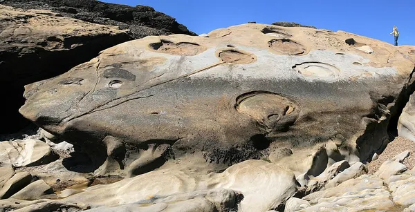
The geological history of Point Lobos, regarding the Point Lobos headland on the Central Coast in Monterey County, California. The area's geology encompasses the last 80 million years. The oldest rocks exposed here were formed during the Cretaceous Period of the Mesozoic Era, when the dinosaurs still roamed the earth and pterodactyls dominated the sky. The area forms part of the Salinian Block, a sliver of continental crust caught up in the transform boundary between the Pacific and North American Plates. Point Lobos is the common name for the landform and area, which include Point Lobos State Reserve on land; and two adjoining marine protected areas: Point Lobos State Marine Reserve (SMR) and Point Lobos State Marine Conservation Area.
Also on this shelf
Coos Bay.
Journey to the Centre of the Earth.
See also
Uncatalogued shelfText from Wikipedia; plate via Wikimedia Commons. Text CC BY-SA 4.0; plate freely licensed (see Commons). Source record. Images and catalogue data are reproduced from open-access collections.