Geology and Minerals
Lava-flow hazard zones
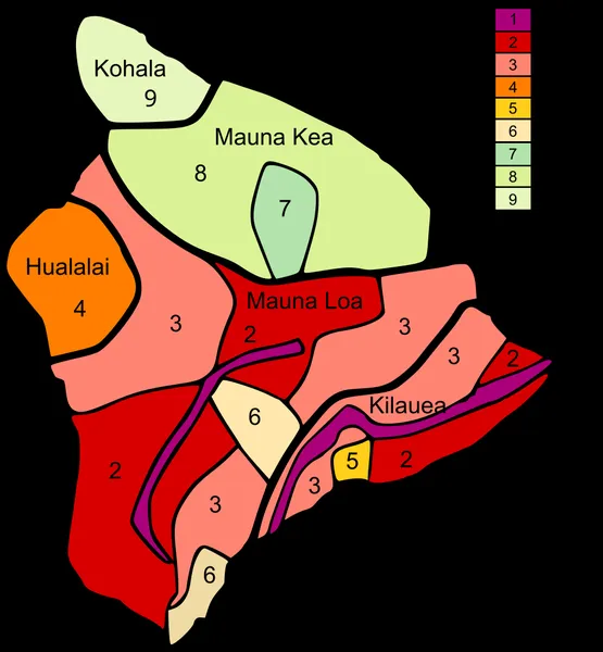
Lava Flow Hazard Zones are areas designated by the United States Geological Survey for the Island of Hawaiʻi and Maui in the United States. First prepared in 1974 by Donal Mullineaux and Donald Peterson of the USGS and revised in 1992 for the Island of Hawaiʻi, the maps outline the qualitative hazard posed by lava flows based on the history of lava flow activity on each of the five volcanoes that form the Island of Hawaiʻi and Haleakalā volcano on the island of Maui. Zone 1 represents the areas that are most hazardous and Zone 9 the least hazardous. Elsewhere in the world, areas around the town of Grindavík have been declared lava-flow hazard zones, and partially damaged by lava flows.
Also on this shelf
Conguillío National Park.
Carrizozo volcanic field.
See also
Uncatalogued shelfText from Wikipedia; plate via Wikimedia Commons. Text CC BY-SA 4.0; plate freely licensed (see Commons). Source record. Images and catalogue data are reproduced from open-access collections.