Geology and Minerals
Geography of Colombia
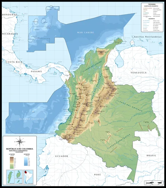
The Republic of Colombia is situated largely in the north-west of South America, with some territories falling within the boundaries of Central America. It is bordered to the north-west by Panama; to the east by Brazil and Venezuela; to the south by Ecuador and Peru; and it shares maritime limits with Costa Rica, Nicaragua, Honduras, Jamaica, the Dominican Republic, and Haiti. Colombia has a land size of 1,141,748 km2 (440,831 mi2) and it is the 25th largest nation in the world and the fourth-largest country in South America (after Brazil, Argentina, and Peru). Colombia's population is not evenly distributed, and most of the people live in the mountainous western portion of the country as well as along the northern coastline; the highest number live in or near the capital city of Bogotá. The southern and eastern portions of the country are sparsely inhabited, consisting of tropical rainforest, and inland tropical plains that contain large estates or large livestock farms, oil and gas production facilities, small farming communities, and indigenous tribes with their territories. Colombia has the 35th largest Exclusive Economic Zone of 808,158 km2 (312,032 mi2).
Also on this shelf
Lake Taupō.
Ironstone.
See also
Uncatalogued shelfText from Wikipedia; plate via Wikimedia Commons. Text CC BY-SA 4.0; plate freely licensed (see Commons). Source record. Images and catalogue data are reproduced from open-access collections.