Geology and Minerals
Charnwood Forest
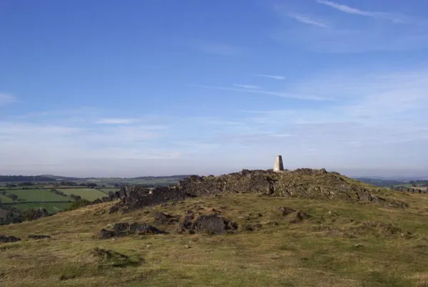
Charnwood Forest is a hilly tract in northwestern Leicestershire, England, bounded by Leicester, Loughborough and Coalville. The area is undulating, rocky and picturesque, with moorland areas. It also has some extensive tracts of woodland, and significant Precambrian geology. Its elevation is generally 600 feet (180 m) and upwards, the area exceeding this height being about 6,100 acres (25 km2). The highest point, Bardon Hill, is 912 feet (278 m). On its western flank lies an abandoned coalfield, with Coalville and other former mining villages, now being regenerated and replanted as part of the National Forest. The M1 motorway, between junctions 22 and 23, cuts through Charnwood Forest. The hard stone of Charnwood Forest has been quarried for centuries, and was a source of whetstones and quern-stones. The granite quarries at Bardon Hill, Buddon Hill and Whitwick supply crushed aggregate to a wide area of southern Britain. The forest is an important recreational area with woodland walks, noted for their displays of bluebells in the early spring, rock climbing and hillwalking. Popular places with public access include Bardon Hill, Beacon Hill, Bradgate Park, Swithland Wood, the Outwoods and Stoneywell cottage (National Trust).
Also on this shelf
Kantishna, Alaska.
Explosive eruption.
See also
Uncatalogued shelfText from Wikipedia; plate via Wikimedia Commons. Text CC BY-SA 4.0; plate freely licensed (see Commons). Source record. Images and catalogue data are reproduced from open-access collections.