Ancient World
Dura-Europos route map
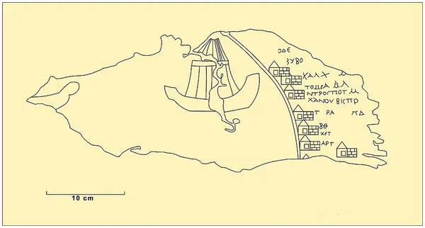
The Dura-Europos route map, also known as stages map, is the fragment of a speciality map from Late Antiquity discovered 1923 in Dura-Europos. The map had been drawn onto the leather covering of a shield by a Roman soldier of the Cohors XX Palmyrenorum between AD 230 and AD 235. The fragment is considered the oldest map of (a part of) Europe preserved in the original. The map is the only road map of antiquity preserved in the original; it is in the manuscript collection of the Bibliothèque nationale de France in Paris.
Also on this shelf
Dendera temple complex.
Iru hillfort.
See also
Uncatalogued shelfText from Wikipedia; plate via Wikimedia Commons. Text CC BY-SA 4.0; plate freely licensed (see Commons). Source record. Images and catalogue data are reproduced from open-access collections.