Ancient World
Bayt Nattif
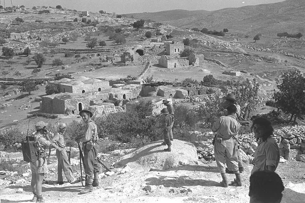
Bayt Nattif or Beit Nattif (Arabic: بيت نتّيف, Hebrew: בית נטיף and בית נתיף alternatively) was a Palestinian village, located some 20 kilometers (straight line distance) southwest of Jerusalem, midway on the ancient Roman road between Beit Guvrin and Jerusalem, and 21 km northwest of Hebron. The village was on a hilltop, surrounded by olive groves and almonds, with woodlands of oak and carobs overlooking Wadi es-Sunt (the Elah Valley) to its south. It contained several shrines, including one dedicated to el-Sheykh Ibrahim. Roughly a dozen khirbas (deserted, ruined settlements) lay in the vicinity. During the British Mandate it was part of the Hebron Subdistrict. Bayt Nattif was depopulated during the 1948 Arab–Israeli War on October 21, 1948 under Operation Ha-Har.
Also on this shelf
Hebraization of Palestinian place names.
Archaeological looting.
See also
Uncatalogued shelfText from Wikipedia; plate via Wikimedia Commons. Text CC BY-SA 4.0; plate freely licensed (see Commons). Source record. Images and catalogue data are reproduced from open-access collections.